What Makes San Antonio’s River Walk Flow Year-Round?
San Antonio's River Walk flows year-round thanks to a sophisticated water management system that supplements natural flow with recycled water. A 3-mile bypass tunnel diverts potential floodwaters, while hydraulic crest gates and strategically placed pumps help maintain consistent water levels. The system includes roughly a 30–35 foot elevation drop that supports natural water movement. Each January, a scheduled multi-day drainage allows for sediment removal and structural inspections. This engineering marvel supports both tourism and local ecosystems.
The Continuous Water Management System Behind the River Walk
While tourists marvel at the serene waters of the San Antonio River Walk, an impressive engineering system works tirelessly beneath the surface. The heart of this system is a sophisticated water recirculation process that keeps the river flowing year-round, even during Texas droughts. When natural spring discharge from the Edwards Aquifer runs low, recycled water from treatment plants supplements the flow. A three-mile tunnel beneath downtown serves dual purposes—diverting floodwaters during storms and helping manage water levels that support the River Walk during dry periods. The tunnel's roughly 30-foot elevation drop allows water to flow naturally through the system with reduced need for additional pumping power. This integrated flood protection network includes hydraulic crest gates at key dams that maintain consistent water levels for boat traffic. Operators can raise or lower these barriers through centralized controls, ensuring the River Walk remains both beautiful and functional regardless of weather conditions.
Biennial Drainage and Maintenance: Keeping the Flow Clean
Beneath the charming surface of the San Antonio River Walk lies a meticulous maintenance routine that few visitors ever witness. Each January, sections of the river undergo a strategic multi-day drainage, allowing crews to access the riverbed directly. During these drainages, teams remove accumulated sediment and debris—a critical process for maintaining water flow and preserving the ecosystem. The sediment disposal processes prevent blockages while improving water clarity and navigability for tour boats. The draining is scheduled in winter months to minimize odor issues that could arise in warmer temperatures. This maintenance window also enables thorough structural inspections of walls, bridges, and channels. Water quality monitoring during this period informs future environmental management strategies. Despite these maintenance efforts, you'll find most of the River Walk remains operational, with businesses open and the main loop accessible to visitors.
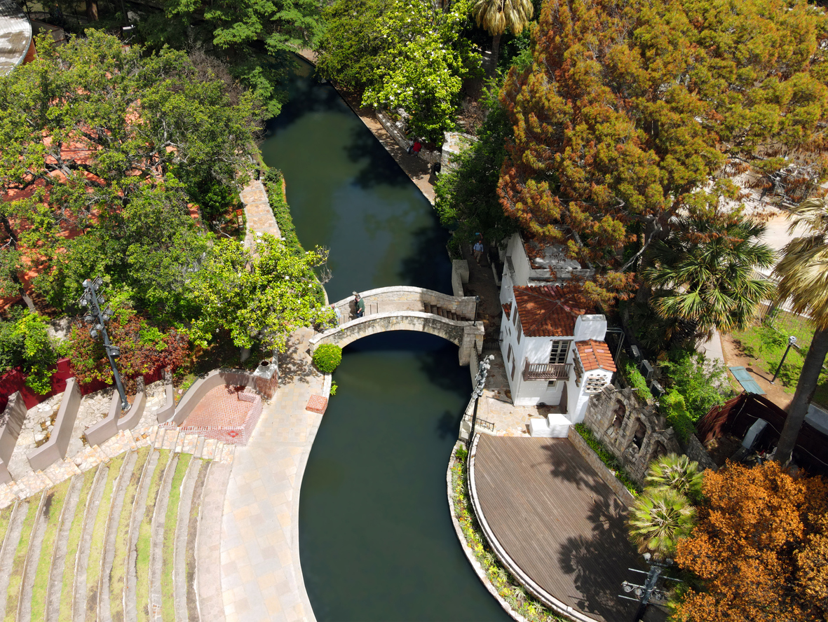
Engineering Marvel: How the River Infrastructure Maintains Water Levels
The technical wizardry behind the San Antonio River Walk extends far beyond its visible beauty. You're actually strolling alongside an intricate flood management system featuring hydraulic crest gates and a 3-mile bypass tunnel that diverts large volumes of potential floodwaters beneath downtown. These modern hydraulic crest gates, operated through centralized controls, maintain ideal water conditions year-round while protecting the area during storms. The Nueva Street Dam Gate 5 replacement included improvements and a bypass system that allows up to 75 cubic feet per second of flow without needing constant gate positioning changes. Sensor-enabled monitoring allows operators to make real-time adjustments, preventing excessive water level drops during maintenance. The system also recirculates water during dry periods through strategically placed pumps. What you're enjoying as a scenic waterway is actually an award-winning engineering achievement that balances flood protection with tourism needs, creating the perfect environment for boats, businesses, and visitors alike.
Environmental Balance: Supporting Ecosystems While Serving Tourists
Maintaining a delicate balance between ecological restoration and tourism infrastructure, the San Antonio River Walk now stands as a model for urban conservation success. You'll notice how the Mission Reach project transformed 334 acres into thriving riparian woodlands, with over 20,000 native trees and a wide range of native plant species creating diverse wildlife habitats. The area has become a critical corridor for resident and migratory birds documented throughout the project. These restoration efforts incorporate sophisticated flood mitigation strategies, using hydraulic modeling to determine safe planting densities that won't impede floodwaters. The native vegetation's deep root systems prevent erosion while filtering pollutants from stormwater runoff. As you explore the 15-mile extension, you're witnessing a carefully designed ecosystem that supports native fish, birds, and migrating species while providing recreational opportunities. This harmonious approach proves that urban waterways can serve both ecological and tourism needs simultaneously.
Year-Round Operations: The Teams That Keep the River Flowing
Behind the serene waters and lush landscapes of the San Antonio River Walk operates a complex, multi-departmental team that works tirelessly year-round to maintain this urban oasis. The Facilities Team manages HVAC, plumbing, and electrical systems across River Authority buildings, while the River Walk Operations Division oversees pedestrian paths, security, and vegetation. Each January, you'll notice scheduled drainage activities as part of ongoing maintenance, with key sections drained for thorough inspection. This multi-department coordination involves the City of San Antonio's Public Works, Center City Development and Operations, and the San Antonio River Authority working in concert. Their collaborative efforts extend beyond maintenance to include event coordination, marketing, and community engagement—all essential components that enhance your visitor experience while preserving the ecological and structural integrity of this iconic attraction. The San Antonio River Authority's focus extends well beyond the River Walk, as the river system flows through multiple counties with interconnected tributaries affecting downstream communities.
Related posts